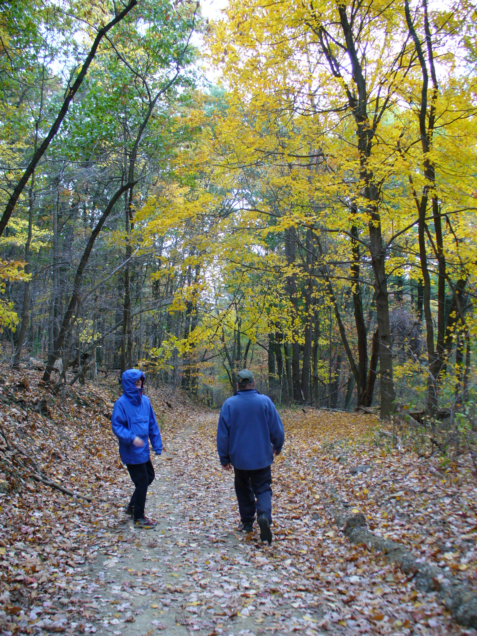
L emailed me Saturday to ask if we wanted to go for a hike Sunday (another Sunday with no Steeler game – they play Monday night). I suggested the Rachel Carson Trail, because I’ve been wanting to check that out for a while now, and she hadn’t ever been on it either. The trail is 35 miles long, between North Park and the Rachel Carson homestead in Springdale. We figured we’d just see how far we could get, starting at North Park.
She said she was pretty sure the trailhead was near the pool, but the website says to park down near the lake spillway, so we thought we’d better do what the website says, since we couldn’t tell by the large-scale map which direction the trail took through the park. So we met at the lakeshore parking area around 1:30; by the time we got there, L had already scouted out where the trailhead was. Hint to future hikers: I suppose there must be some reason for the trail to head across a little causeway, then double back through the woods around a pond so that you re-cross the road right near your car after hiking for 10 minutes, but I can’t think what it might be. You’re better off to cross Babcock Rd at the Pearce Mill intersection, and begin to follow the yellow blazes from there — heading down the bank of the spillway.

From there the trail goes past some condos, and crosses Wildwood Rd near a gas station, then heads up through the woods toward the pool. So, yes, we would’ve been further ahead to park at the pool and go east from there — we could’ve ended up going further on the trail before having to turn around to make it back to the cars before an early sunset. On the other hand, we would’ve missing seeing this abandoned shelter, which I think harks back to the days of the little ski slope that used to run down to Wildwood Rd. We passed several other ancient picnic shelters as we went along too, I guess they’ve ended up too far off the beaten path for people to use… too far away from playgrounds and parking I guess, though they were in very picturesque locations.

After criss-crossing a number of other walking trails up near the pool, the trail headed down an old roadway, complete with stone walls and drains. L thinks it’s used for park maintenance, but it looked like it used to be an actual road… a very long time ago.
The trail then crossed a road which was under “destruction”, apparently due to a wash-out — we had to sort of clamber past the heavy equipment that was parked in the middle of the trail. Then we headed down a steeper hill toward a creek — unfortunately I don’t know which — I think it was too small to have been Pine Creek though.

The trail then runs through really quite a pretty little gorge, with rock ledges on the sides and the stream at the bottom. I didn’t realize there was anything like that in that area. I think by that point we had left North Park. Along the stream we noticed a lot of old [cast iron?] natural gas lines, some of which were in the process of being replaced by PVC pipe, but only in segments joined to old sections here and there, which we thought odd. Al said he guessed it was due to permitting issues. He thinks that as long as the gas company could say they were only “repairing” the line, not replacing it, they could operate under their old permits. He figures next year they’ll come back and “repair” the remaining iron segments.

After a good while along the creek, the trail came out onto a rail line, and turned right along it. There was a bunch of rail maintenance equipment on a siding just before we came out onto Wildwood-Sample Rd. The trail went along the road for about 1/4 mile, if that, and then cut down over a bank to a creek again. Unfortunately it was about then that it was 3:00, and we figured that needed to be our time to turn around in order to be sure to get back before dusk. We did “cheat” and walk straight to our cars at the end, rather than taking the 10-minute detour around the pond.
No idea really how many miles we came. We did scope out a couple parking spots along the road there though, so we can start there the next time, and do the next segment. Overall, it’s a very interesting trail, with lots of variety in environment and topography. We found the trail to be very well marked with yellow paint blazes, which was good since we didn’t have a map or guide. From what I understand, the section nearer to Springdale is more rugged, so I’m looking forward to exploring more of it.
So here’s my new personal goal: to be fit enough to be able to participate in the 2008 Rachel Carson Trail Challenge next summer solstice. You get all 15 hours of daylight to go the 34 miles of rugged trail — hiking, running, whatever. I think that probably means getting back off my butt now :-b … I’ve kind of let the workouts slide since making it to the 5-mile race in July. There, now I’ve said it out loud (or at least in print), so now I need to do it!

34 miles in 15 hours! I'm impressed. What kind of workouts are you anticipating to get ready for this?
A fair question! Erm, well, I was thinking that sounds like a brisk walking pace, just for a long time, so I plan to work on general fitness and endurance. I've started back to the gym in the mornings (well, sometimes) – am trying the elliptical machine, which seems to me to best simulate rough terrain. So far, I've been doing 1/2 hour at the "varied" setting, which is fairly difficult. But the machines are limited to 1/2 hour, so I'll have to do something else in addition. I'm also just generally trying to walk briskly a lot more throughout the day. But I really do need to work out an actual plan, like I did for the 5-mile race in July. Something to push me to reach certain goals each week.